Flers / Domfront


You change cycle track after Flers station. Crossing the outskirts of town, near La Selle-la-Forge, at the place named Fumeçon, a greenway’s compact track takes you down a gentle slope to the Varenne River, which you’ll get close to many times along this stage. The local heritage recalls the area’s mining past as well as its agricultural past. Take it all in on what is a peaceful stretch for cyclists.
Gradients and elevation
Slope breakdown
Road types
- Cycle path
- Routes reserved for cyclists and pedestrians (greenways, cycle tracks, towpaths), separated from cars for maximum safety.
- Shared road
- Quiet minor roads with little traffic (unless otherwise stated in the stage details). Shared with cars (stay alert).
- Not specified
- Data unavailable or being assessed. Please refer to the detailed stage description.
- Provisional
- Section on a road or cycle path awaiting better-quality facilities (see stage details).
Surface
- Smooth
- Asphalt, tarmac or smooth concrete. Optimal comfort.
- Rough
- Fine gravel, compacted stabilised surface or worn tarmac. Less comfortable, vibrations possible.
- Natural
- Dirt, grass, roots or stones. Under 5%: short sections with little impact. Higher percentage: route suited to mountain or gravel bikes only.
- Not specified
- Data unavailable or being assessed. Please refer to the detailed stage description.
The route
Leaving from Flers station, the route soon takes you on to the greenway, which you join at Fumeçon. This track is smooth and compact and so easy to cycle along. Do take care though when crossing the motorised roads along the way.
To join the centre of Domfront town and its tourist office, which stand on a rocky outcrop over 70m above the surrounding countryside, join the signposted La Véloscénie cycle route and dismount if necessary. The way up to the old town is very steep, but the historic centre and the views make the detour worthwhile.
Tourist Offices
SNCF Train Services
Flers station: on the regional TER line Paris/Granville – Stops at: l’Aigle, Surdon, Argentan, Briouze, Flers
www.ter.sncf.com/basse-normandie
Buses
Line n°25 - Flers > Saint-Bomer-les-Forges > Domfront > Lonlay-l’Abbaye
Cap Orne - www.orne.fr/node/1254: +33 (0)2 33 81 61 95. Bicycles can be put in the hold if there is sufficient room. Check with the transport company beforehand: +33 (0)2 33 65 61 61 www.vtni61.fr
Markets
Flers: Wednesdays and Saturdays
Domfront: Fridays
Don’t miss
Flers: In the heart of town, the château grounds stretch across 7 hectares around a lake, offering a quiet spot for a walk or a pause in the centre of town.
La Maison du Fer: On a visit to the Maison du Fer de Dompierre, learn about the history of iron ore mining in the Normandy county of Orne since medieval times. The mining heritage in the area’s bocage (characterized by land divided up by ancient hedgrerows) is quite exceptional, both historically and architecturally.
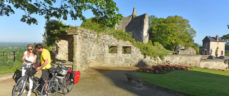
Domfront: Built as a medieval citadel, the historic heart of town stands 70m above the Varenne River. The powerful ruins of the keep help recall the fact that this fort was ordered at the start of the 12th century by Henri Beauclerc. William the Conqueror’s youngest son, he became King Henry I of England in 1100, then also Duke of Normandy. The defences here were built to guard the southern frontier of his Norman duchy.
Guided tours possible. Tel: +33 (0)2 33 38 53 97
- Notre-Dame-sur-l’Eau Church, dating from the 11th and 12th centuries.
- Saint-Julien Church, in Neo-Byzantine style…